Map Wizard - Select Your Data
Click the Home | Wizard | Map Wizard command to open the Map Wizard. The first page is the Select Your Data page. Here you select the data, grid, boundary, or image file you wish to use to create your map. Once you have selected your data source, click Next to proceed to the Select Your Map Type page.
|
|
|
Specify the data file and coordinate columns or grid file you wish to use to create a map. |
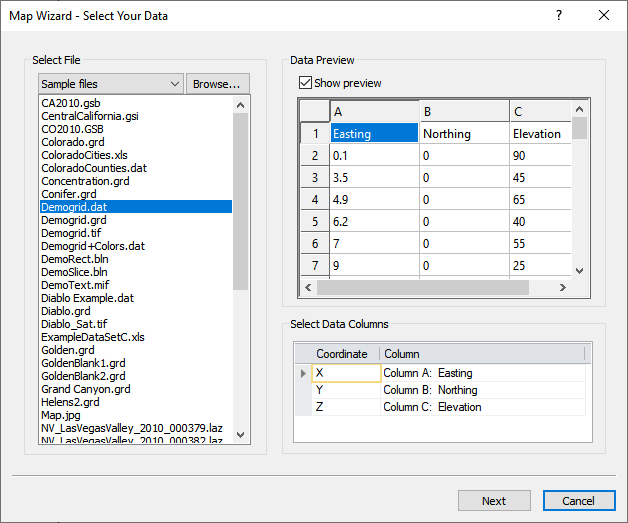
Select File
Select your data, grid, vector, or image file in the Select File list. The Select File list includes a list of Recent files, Sample files, Project files, or files in a folder you select with Browse. To change the Select File list, click the current selection at the top of the list and select Recent files , Sample files, Project files, or Browse.
Recent Files
When Recent files is selected in the Select File list, the most recently opened files are displayed in the Select File list. By default the number of files in the Recent files list is 10. Change the number of files in the Recent files list in the Options dialog User Interface page.
Sample Files
When Sample files is selected in the Select File list, the sample files included with Surfer are displayed in the Select File list.
Project Files
When Project files is selected in the Select File list, the files located in the user defined project folder are displayed in the Select File list. The Project folder option can be set in the Options dialog on the General page or in the Welcome to Surfer dialog.
Browse
Click Browse near the Select File list to open a file with the Open dialog. After you select a file in the Open dialog, the file preview is loaded in the Select Your Data page and the folder contents are visible in the Select Files list.
Import or Load Options
Depending on the data file that is selected, an additional dialog may appear that requires further selection. For example, if selecting a multi-tabbed spreadsheet, you may be prompted to select one of the sheets of the spreadsheet data. If selecting a LiDAR data file, you are prompted to load the file as Point cloud or Data points data. When loading LiDAR data as a point cloud, only the point cloud layer type can be created. When loading LiDAR data as data points, the data is treated like any other data file, and any layer type, except points cloud layers, can be created.
Data Preview
The Data Preview section contains a preview of the selected file. Check the Show preview check box to see a preview of the selected data, grid, or boundary file. When a file is selected in the Select File list, the file is loaded and a preview is displayed. The Surfer status bar displays the loading progress for large data files.
-
Data files are displayed in a table.
-
Grid files are displayed as a color relief map.
-
Boundary files are displayed as a base map.
Clear the Show preview check box to hide the preview.
Select Data Columns
When a data file is selected in the Select File list, the Select Data Columns section is displayed. Specify the columns that contain the X, Y, and Z data in the Select Data Columns table. The Coordinate column indicates the row for the X, Y, and Z selections. The Column column includes the column letter and, if a header row is present, the column header. To change a selection, click the column you wish to changed and select the desired column from the list.
Next and Cancel
Click Next to proceed to the Select Your Map Type page. Click Cancel to close the Map Wizard without creating a map.