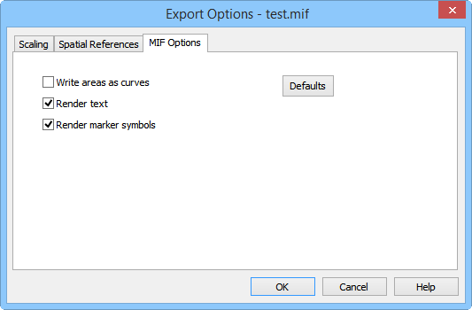
MapInfo Interchange Format .MIF Export Options Dialog
The Export Options dialog allows you to specify options which determine how information in the file is exported.
Attributes
All attributes for all polyline and polygon objects are automatically exported to all .MIF files. For contour maps, the Z value is exported as the "ZLEVEL" attribute for all polylines in the contour map.
|
|
|
Specify the MIF export options in the Export Options dialog, MIF Options page. |
Write Areas to Curves
Checking Write areas as curves converts all area objects (polygons) to curve objects (polylines) during export.
Render Text
Check Render text to cause all text objects to be exported as areas and lines. When Render Text is unchecked, text is exported as text.
As long as there is no shear, perspective, or clipping, MIF text entities will be exported as text. This means that the MIF text entities will be sized and oriented similar to the text objects in the application document. When shear, perspective, or clipping occur, the text is exported as solid polygons. Shear occurs when the character glyphs are not perpendicular to the text baseline. Perspective occurs when the height of glyphs in the text string are not all the same, as in a 3-D view where the glyphs are smaller the farther they are from the observer. Clipping occurs when part of the text object is partially inside and partially outside the map limits.
Render Marker Symbols
Check Render marker symbols to cause markers to be exported as areas and lines.
See Also
MapInfo Interchange Format (MIF) File Description
