Geographic Coordinate System
|
|
|
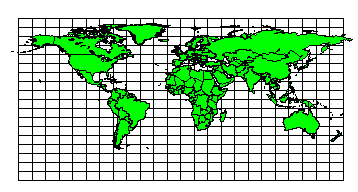
World Map |
Projection Characteristics
This is a simplistic cylindrical projection. If the coordinates in a Surfer map layer are stored in a geographic coordinate system (also known as Unprojected Lat/Long or latitude/longitude), the map is displayed on the screen by simply treating the longitudes as horizontal offsets and the latitudes as vertical offsets.
When plotting latitude/longitude coordinates, Surfer constructs the map coordinate system by first determining the latitude for the center of the map. Then the appropriate scale is determined for the east-west (longitude) relative to the north-south (latitude) dimension of the map. See latitude/longitude and Using Scaling to Minimize Distortion on Latitude/Longitude Maps for more information on relative scaling of latitude versus longitude.
The features of a geographic coordinate system (Unprojected Lat/Long) map are:
-
Meridians (lines of constant longitude) are equally spaced and are drawn perpendicular to the parallels.
-
Parallels (lines of constant latitude) are equally spaced over the entire map and are drawn perpendicular to the meridians. The further your map area is from the equator, the further apart the parallels are spaced.
-
The spacing between meridians is different than the spacing between parallels except when the equator is at the north-south center of the map.
-
At the center of the map, the scale is accurate in both the north-south and east-west direction.
-
Scale is accurate in the north-south direction over the extent of the map.
-
East-west scale increases towards the poles, and decreases towards the equator.
There are no parameters for this coordinate system.
See Also
Map Coordinate Systems Overview
Introduction to Map Projections
Source Coordinate System - Map Layer
Target Coordinate System - Map