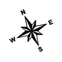
Create a North Arrow
A North arrow can be added to a map multiple ways. By drawing a symbol, the north arrow is a page object and cannot be layered with a map. By creating a post map or base map symbol, the map can be layered with other maps.
To Draw a North Arrow Symbol
This method allows you to draw a North arrow as a page object.
-
Create a new point object using the Home | Insert | Point command.
-
Left-click on the plot window where you want the north arrow to be displayed. The default symbol is drawn. Press the ESC key to exit the draw mode.
-
After the point is drawn, click once on the point to select it. The symbol properties are shown in the Properties window.
-
Change the Symbol Set to either GSI Default Symbols or GSI North Arrows.
-
Select a North arrow Symbol (i.e. GSI Default Symbols Number 64 - 71, or GSI North Arrows Number 1 - 25).
-
Change the Size to make your north arrow larger to fit your needs. Change the Fill color, Line color, Fill opacity, and Line opacity to fit your needs. The north arrow is displayed with the specified properties.
-
You can rotate the North arrow to the desired angle to make sure it lines up correctly with the North orientation. Select the symbol and use the Layout | Layout | Rotate | Rotate command.
-
In the Rotate dialog, enter a value in the Counterclockwise rotation in Degrees box. Click OK. The North arrow is rotated the specified angle.
|
|
|
This North arrow is rotated to 25 degrees. The GSI North Arrows symbol set Number 9 is used. |
To Add a North Arrow as a Post Map
This method allows you to specify exact X, Y map coordinates to display a North arrow.
-
Create a data file in the worksheet with the X, Y map coordinates where you want the North arrow to appear on the map. You can get the coordinates manually from your map, or by right-clicking on the map and selecting the Digitize option.
-
Click the Home | New Map | Post command, specify the .DAT file name, and click Open to display a new post map with default symbol at the coordinate location specified in the data file.
-
Click on the post map to select it. The properties are displayed in the Properties window.
-
On the Symbol page, open the Symbol section. Open the Symbol Properties section. Change any of the symbol properties.
-
Change the Symbol Set to either GSI Default Symbols or GSI North Arrows.
-
Select a North arrow Symbol (i.e. GSI Default Symbols Number 64 - 71, or GSI North Arrows Number 1 - 25).
-
Change the Fill color, Line color, Fill opacity, and Line opacity to fit your needs. The north arrow is displayed with the specified properties.
-
In the Symbol Size section, set the Sizing method to Fixed size and change the Symbol size to make your north arrow larger to fit your needs.
-
You can rotate the North arrow to the desired angle to make sure it lines up correctly with the North orientation. In the Symbol Angle section, change the Default angle (degrees) until the north arrow is aligned correctly.
-
Overlay the north arrow post map with other maps if desired.
|
|
|
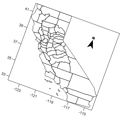
This North arrow is a post map layer on a base map of California. The GSI North Arrows symbol set Number 6 is used. The map is rotated to -20 degrees. |
To Add a North Arrow as a Base Map
You can draw a North arrow symbol that will be included in the base map coordinates. The North arrow symbol will be a part of the base map and able to be layered and scaled.
-
Create a base map with the Home | New Map | Base | Empty Basemap command.
-
Create a new point object using the Home | Insert | Point command.
-
Left-click in the base map boundaries where you want the north arrow to be displayed. The default symbol is drawn. Press the ESC key to exit the draw mode.
-
After the point is drawn, click on the symbol to open the symbol properties in the Properties window.
-
Change the Symbol Set to either GSI Default Symbols or GSI North Arrows.
-
Select a North arrow Symbol (i.e. GSI Default Symbols Number 64 - 71, or GSI North Arrows Number 1 - 25).
-
Change the Size to make your north arrow larger to fit your needs. Change the Fill color, Line color, Fill opacity, and Line opacity to fit your needs. The north arrow is displayed with the specified properties.
-
If needed, rotate the North arrow to the desired angle to make sure it lines up correctly with the North orientation. Select the symbol and use the Layout | Rotate | Rotate command.
|
|
|
The base map polygons are filled in gray. The base map background is blue. |


