Import
The Home | Insert | Graphic, the Home | New Map | Base, and the Home | Add to Map | Layer | Base commands in the plot window open the Import dialog.
|
|
|
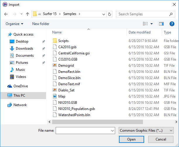
Select files to import using the Import dialog. |
Look In
The Look in field shows the current directory. Click the down arrow to see the directory structure. Click on the folders to change directories.
Creating New Folders and Changing the View
The buttons to the right of the Look in field allow you to create new folders and change the view of the file list.
File List
The file list displays files in the current directory. The current directory is listed in the Look in field. The Files of type field controls the display of the file list. For example, if Golden Software Boundary (*.GSB) is listed in the Files of type field only .GSB files appear in the files list. To see all files in the directory, choose All Files (*.*) from the Files of type list.
Double-click on a file to open it or single-click the file and then click the Open button. To import more than one file, select the files you wish to import by holding CTRL while clicking, and then click Open. When adding images with Home | Insert | Graphic, each file is added as an image a group. When adding base maps with Home | New Map | Base, each file is added as a separate map.
File Name
The File name field shows the name of the selected file. Also, a path and file name can be typed into the box to open a file.
Open Files
Surfer tracks the files being used by maintaining a list of opened files for new maps and the files used in saved maps. The file(s) used in existing maps are shown in a compiled list in the Open images field of the Import dialog.
Files of Type
The Files of type field shows the file format to be opened. To change the file format, click the down arrow and select the file type from the list.
The Common Graphic Files (*...) format type is selected by default. This displays all the file formats that can be imported with Home | Insert | Graphic in the navigation pane. If a different format type is selected, Surfer will remember the setting until the end of the current session. When Surfer is restarted, the default format type will be used.
To see all files in the directory, choose All Files (*.*) from the Files of type list. Double-click on a file to open it or single-click the file and then click the Open button. The All Files (*.*) option shows all of the file formats in the current directory, even if the file type is not appropriate for the action chosen.
Import Format Types
The Home | Insert | Graphic command in the plot document opens the Import dialog. In the Import dialog, select one of the following formats to import objects into the plot.
- 000 IHO S-57 Navigation Chart (*.000)
- AN? ACR-NEMA Medical Image (*.an1, *.an2)
- BLN Golden Software Blanking (*.bln)
- BMP Windows Bitmap (*.bmp)
- BNA Atlas Boundary (*.bna)
- DICOm3 Medical Image (*.dic, *.dcm)
- DDF SDTS TVP (*.ddf, *.tar, *.tar.gz, *.zip, *.tgz)
- DGN MicroStation Design v7 (*.dgn)
- DLG USGS Digital Line Graph (*.dlg, *.lgo, *.lgs)
- DXF AutoCAD Drawing (*.dxf)
- E00 Esri ArcInfo Export Format (*.e00)
- ECW ERMapper (*.ecw)
- EMF Windows Enhanced Metafile (*.emf)
- GEOJSON JSON Data Interchange (*.geojson, *.json)
- GIF Image (*.gif)
- GML Geograpy Markup Language (*.gml)
- GPX GPS Exchange Format (*.gpx)
- GSB Golden Software Boundary (*.gsb)
- GSI Golden Software Interchange (*.gsi)
- JPG Compressed BItmap (*.jpg, *.jpeg)
- JPEG-2000 Bitmap (*.jp2, *.j2k, *.jpc, *.jpt, *.jpeg2000, *.j2000)
- KML Google Earth Keyhole Markup File Description (*.kml, *.kmz)
- MIF MapInfo Interchange Format (*.mif)
- PDF Adobe PDF (Vector or Raster) (*.pdf)
- PLT Golden Software PlotCall (*.plt)
- PLY Stanford PLY (*.ply)
- PNG Portable Network Graphics (*.png)
- PNM/PPM/PGM/PBM Image (*.pnm, *.ppm, *.pgn, *.pbm)
- RGB SGI-RGB Image (*.rgb, *.rgba, *.bw)
- RT Tiger/LINE (*.rt)
- SEG-P1 Exchange Format (*.sp1, *.seg)
- SHP Esri Shapefile (*.shp)
- SID LizardTech MrSID Image (*.sid)
- SUN Sun Raster Image (*.ras, *.sun)
- TAB MapInfo Table (Vector) (*.tab)
- TGA Targa (TrueVision) (*.tga)
- TIF Tagged Image (*.tif, *.tiff)
- VCT Idrisi Binary Vector (*.vct)
- VTK Visualization Toolkit (*.vtk)
- WMF Windows Metafile (*.wmf)
- X AVS X-Image (*.x, *.ximg)
Open Images
Surfer tracks the files being used by maintaining a list of opened images for new maps and the images used in saved maps. The images(s) used to build maps can be opened from the compiled list in the Open Grids field of the Open Grid dialog. The only exception is that vector data between base layers will not be shown.
Import Format Types
The Home | Insert | Graphic command in the plot document opens the Import dialog. In the Import dialog, select one of the following formats to import objects into the plot.
- 000 IHO S-57 Navigation Chart (*.000)
- AN? ACR-NEMA Medical Image (*.an1, *.an2)
- BLN Golden Software Blanking (*.bln)
- BMP Windows Bitmap (*.bmp)
- BNA Atlas Boundary (*.bna)
- DICOm3 Medical Image (*.dic, *.dcm)
- DDF SDTS TVP (*.ddf, *.tar, *.tar.gz, *.zip, *.tgz)
- DGN MicroStation Design v7 (*.dgn)
- DLG USGS Digital Line Graph (*.dlg, *.lgo, *.lgs)
- DXF AutoCAD Drawing (*.dxf)
- E00 Esri ArcInfo Export Format (*.e00)
- ECW ERMapper (*.ecw)
- EMF Windows Enhanced Metafile (*.emf)
- GEOJSON JSON Data Interchange (*.geojson, *.json)
- GIF Image (*.gif)
- GML Geograpy Markup Language (*.gml)
- GPX GPS Exchange Format (*.gpx)
- GSB Golden Software Boundary (*.gsb)
- GSI Golden Software Interchange (*.gsi)
- JPG Compressed BItmap (*.jpg, *.jpeg)
- JPEG-2000 Bitmap (*.jp2, *.j2k, *.jpc, *.jpt, *.jpeg2000, *.j2000)
- Images are typically imported into Surfer as a base map by clicking the Home | New Map | Base command.
- KML Google Earth Keyhole Markup File Description (*.kml, *.kmz)
- MIF MapInfo Interchange Format (*.mif)
- PDF Adobe PDF (Vector or Raster) (*.pdf)
- PLT Golden Software PlotCall (*.plt)
- PLY Stanford PLY (*.ply)
- PNG Portable Network Graphics (*.png)
- PNM/PPM/PGM/PBM Image (*.pnm, *.ppm, *.pgn, *.pbm)
- RGB SGI-RGB Image (*.rgb, *.rgba, *.bw)
- RT Tiger/LINE (*.rt)
- SEG-P1 Exchange Format (*.sp1, *.seg)
- SHP Esri Shapefile (*.shp)
- SID LizardTech MrSID Image (*.sid)
- SUN Sun Raster Image (*.ras, *.sun)
- TAB MapInfo Table (Vector) (*.tab)
- TGA Targa (TrueVision) (*.tga)
- TIF Tagged Image (*.tif, *.tiff)
- VCT Idrisi Binary Vector (*.vct)
- VTK Visualization Toolkit (*.vtk)
- WMF Windows Metafile (*.wmf)
- X AVS X-Image (*.x, *.ximg)
Remarks
- To open Golden Software Blanking .BLN and Atlas Boundary .BNA files in the worksheet use File | Open in Worksheet rather than Home | Insert | Graphic.
- Images are typically imported into Surfer as a base map by clicking the Home | New Map | Base command.
- Where applicable, Surfer automatically imports all available attribute information.